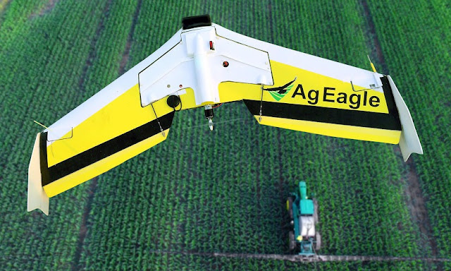
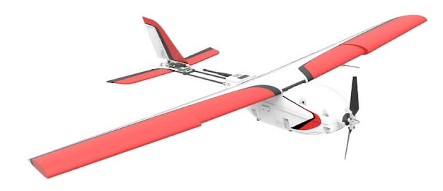
Listed below are the most popular ready-to-fly agriculture drone/UAV/UAS systems in the world, both fixed-wing and multi-rotor.
All of these unmanned aerial survey drones are delivered ready-to-fly and are equipped with all the software, sensors and hardware you’ll need to check the health of crops, track livestock and survey farmland.
The market is changing quickly, however.
Some of the early entrants are gone now, and most suppliers update their prices, features, rigs and software packages on what seems like a monthly basis. Make sure you check the manufacturer’s website for the latest details.
The Best Fixed Wing Ag Drones
Fixed-wing UAVs are the best choice when you have to cover a lot of ground, fast. Fixed-wing ag drones can cover up to 10 times the acreage that a typical quadcopter can cover in a single flight.
That said, image quality can suffer due to the speed. For example, fixed wing UAVs are often unable to capture survey-grade 3D / topographic detail
PrecisionHawk Lancaster 5
In addition to the mandatory downward-facing multispectral sensor, the Lancaster carries on-board sensors that measure humidity, temperature, air pressure along with incident light, all in real time. It then uses artificial intelligence to react to changing weather conditions, payload, changing wind loads, visibility, etc.
Flight Planning
Flight planning couldn’t be simpler – just select your target altitude and desired ground resolution, and the Lancaster creates a flight plan automatically. Then, just toss the aircraft like a paper plane, to begin your survey.
When it’s finished, the Lancaster will land itself, automatically.
Flight Control
PrecisionHawks’ InFlight flight monitoring and tracking software gives you real-time data on flight path, position, altitude, aircraft performance and battery life.
Sensors
The Lancaster platform is built on open source software that makes it easy for developers to design & integrate sensors for any need.
A wide range of sensors are available to capture visual, thermal/IR, multispectral, LIDAR and hyperspectral data.
Changing a sensor is a snap, too – the process is 100% Plug and Play, with no configuration required.
Mapping and Analysis
The Lancaster 5 comes with PrecisionHawk’s outstanding DataMapper data management and analysis solution. Available as desktop software or through the cloud, DataMapper produces accurate 2D and 3D maps into geo-referenced mosaics.
From there, you can process field data using algorithms and indexers available on the DataMapper AlgoMarket
.On AlgoMarket, you can select and purchase data processing for any purpose – a wide range of indices are available including:
- Plant height
- Plant count
- Enhanced NDVI
- Field Uniformity
- Volume measurement
- Optimized Soil Adjusted Vegetation Index (OSAVI)
- Water pooling
- And many more
PrecisionHawk Lancaster 5 Specifications
- 5.3 lbs dry weight
- 2.2 lb payload
- 45 minute flight time
- 2km / 1.2 mile range
- 300 acres per flight (300 ft altitude)
- Plug-and-Play sensor bay
- 5-channel multispectral camera available
- One-button press to launch (cool feature)
- Data resolution down to 1 cm/pixel
Tag :
Drone Preview,
Drone Review


0 Komentar untuk "The Best Agriculture Drones"